Services
As an independent GIS software consultant and developer, I help businesses harness the power of geospatial data through data ingestion, analysis, visualization, and system integration. I design and build solutions that make location-based data actionable, whether for internal use, customer-facing applications, or third-party integrations. The key areas of focus are outlined below.
-
Geospatial Data Ingestion & Geocoding
I provide services for integrating geospatial data from sources like OpenStreetMap and custom datasets into business systems, dedicated data stores, or my own processing workflows. When location data is available in the form of addresses or place names, I apply geocoding solutions such as Nominatim to convert it into geographic coordinates, enabling richer spatial insights and more actionable data.
OpenStreetMap amenities data imported into PostgreSQL and accessed via custom-built RESTful API. See working example at Twoja Okolica .Online 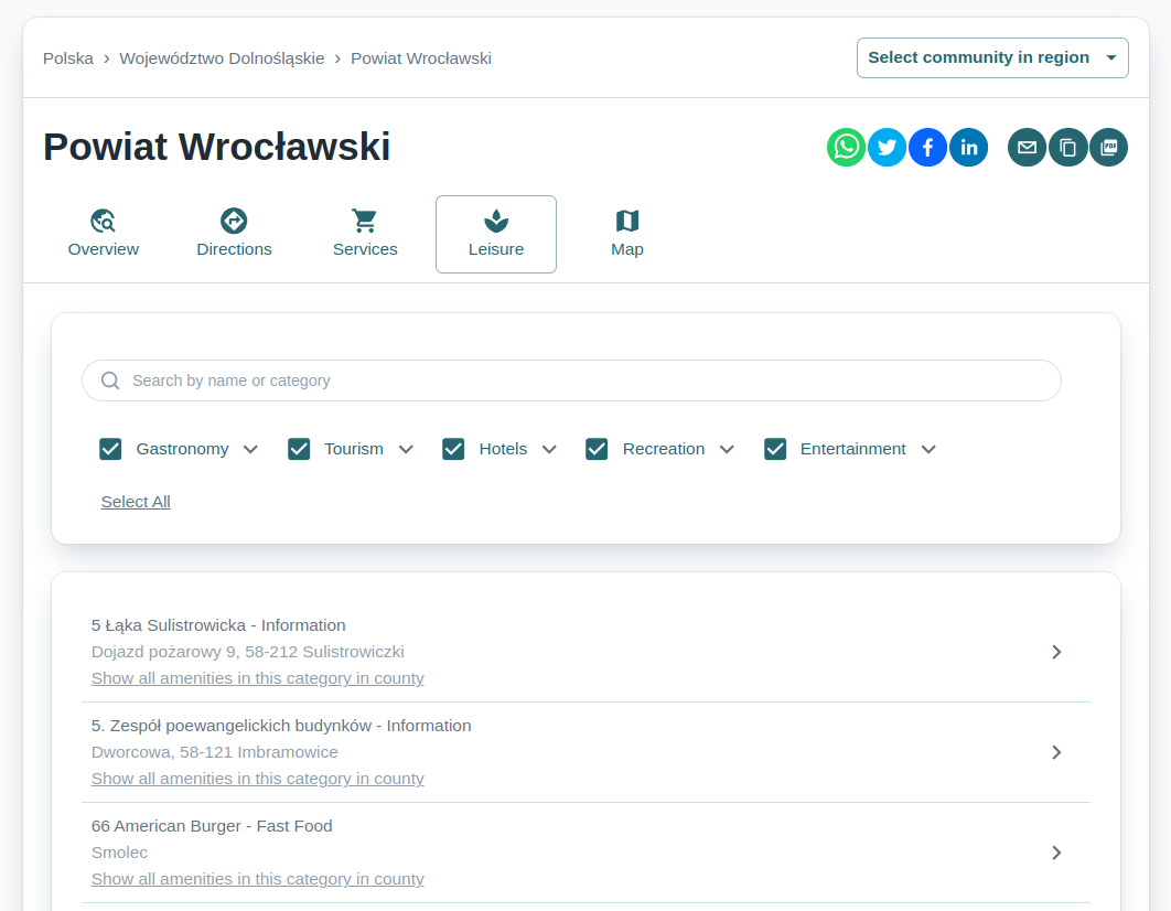
-
Geographical Data Processing & Analysis
I process spatial data to deliver actionable insights through both statistical and network-based approaches. This includes data grouping and enrichment to reveal meaningful patterns, as well as generating navigation routes and calculating isochrones using Valhalla. These methods help uncover spatial relationships, improve decision-making, and support a wide range of geospatial applications.
WorldPop population data applied to administrative regions extracted from OpenStreetMap dataset. See working example at Twoja Okolica .Online 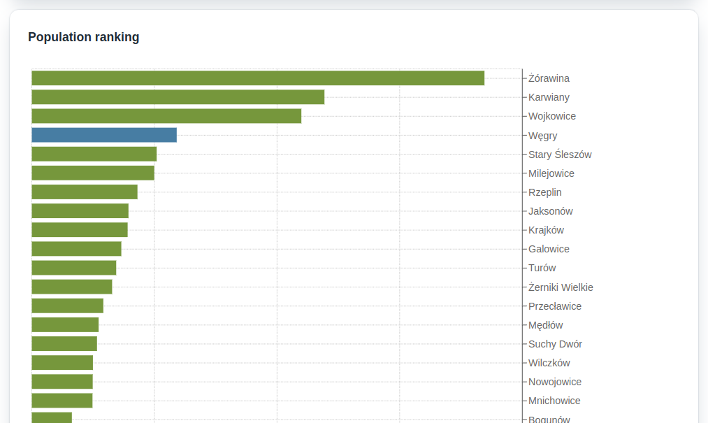
-
Custom Web Applications and Widgets
I design and develop interactive geospatial applications that allow users to engage with spatial data through custom maps, real-time data tables, and intuitive navigation tools. Depending on the need, I build anything from lightweight embedded widgets to full-featured web applications—ensuring each solution is tailored to the specific use case and seamlessly integrates with existing systems or platforms.
Mapbox based map with amenities extracted from OpenStreetMap dataset. See working example at Twoja Okolica .Online 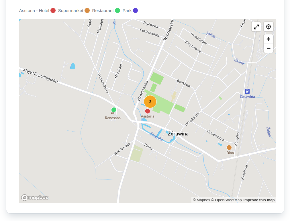
-
Printable Geospatial Data Presentation
I create high-quality printable exports of geospatial data in formats such as PDF and Excel to support reporting, compliance, and offline analysis. Each export features customizable map designs and layouts, ensuring that spatial information is communicated clearly and effectively. Outputs are tailored to meet specific business needs, making complex data accessible and presentation-ready.
Printable map stretching automatically to selected page size and layout. See working example at Twoja Okolica .Online 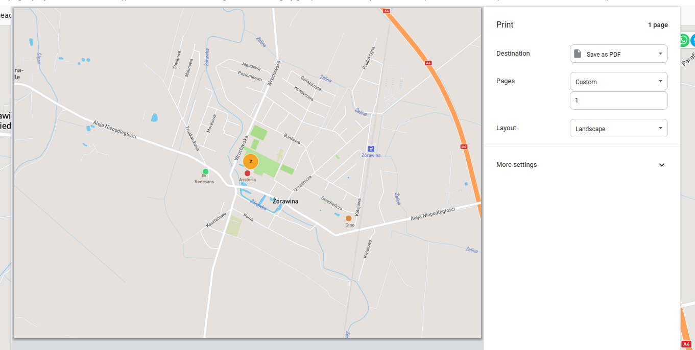
-
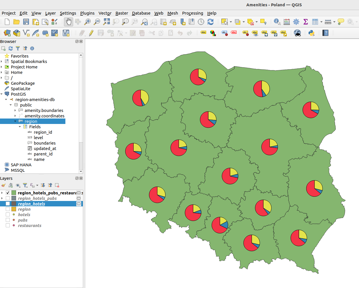
Geospatial Data Integration with GIS Tools
I prepare and export geospatial data for use in desktop GIS applications such as QGIS, enabling advanced spatial analysis, custom mapping, and in-depth visualization. By supporting standard geospatial formats and coordinate systems, I ensure full compatibility with professional GIS workflows. This integration allows spatial datasets to be explored and utilized beyond their initial processing environments, extending their value across tools and contexts.
OpenStreetMap data imported via PostGIS to QGIS for further analysis - number of restaurants (red), pubs (blue) and hotels (yellow) in administrative regions in Poland.